Potholes NI
I was looking for some open source data that I could use the produce something useful in the real world. OpenDataNI has many data sets available, one of which was data on road defects. This dataset contained all road defects reported for carriageways in Northern Ireland. What problem could this data solve?
The Problem
Context
For anyone driving on UK roads a major hazard for them is hitting a pothole, which can cause damage to the vehicle, cause loss of control or just the shock of the vehicle reaction when hitting one at speed can be a scary incident. They can be difficult to spot, avoid and they are not the only thing you watch out whilst driving.
Local government can have claims made against them to contribute to the cost of repairs due to damage from potholes. So not only do they bear the cost of actually repairing the pothole, but also potentially any damage caused in the lead time to repair (should any claim be made).
Impact
- Additional cost to local government
- Additional cost to road user
- Road user distress
- Vehicle damage/Road traffic Incidents(Accindents)
Mitigation
There is no solution to the defects on the carriageways and the effects it has on users as time to repair is not instant , but it could be mitigated.
Options
| Mitigation | Problem | Likelyhood |
|---|---|---|
| Mark dangerous defects with reflective paint on the road surface. A particular artist tried graffiti and their handle sounds similiar to Banksy, comical (to me anyway), did get things fixed on grounds of the offensive nature of the graffiti. | Time spent painting could be spent fixing | Low |
| Include data into all navigation Applications | Standardising all data formats or converting to meet platform requirements | Medium/Low |
| Individual buy in, to download an Application | Advertising and long term support(cost) | Low |
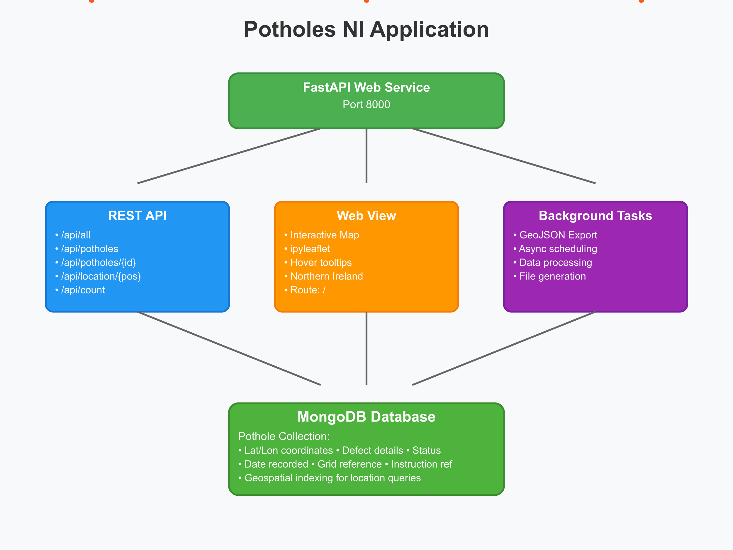
The Journey
Application Architecture